
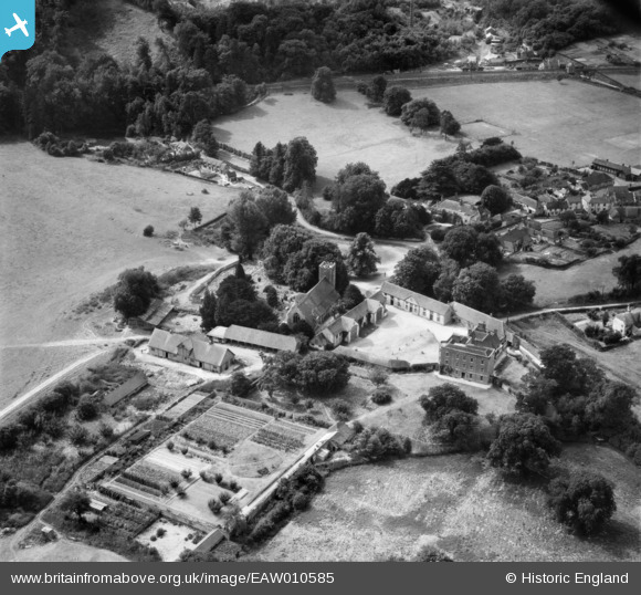
EAW010585 ENGLAND (1947). St Mary's Church, the Manor House and the village, Buriton, 1947
© Copyright OpenStreetMap contributors and licensed by the OpenStreetMap Foundation. 2026. Cartography is licensed as CC BY-SA.
Nearby Images (8)
EAW010585

EAW010588

EAW010587

EAW010586

EAW010589

EAW010590

EAW010584

EAW010583

Details
| Title | [EAW010585] St Mary's Church, the Manor House and the village, Buriton, 1947 |
| Reference | EAW010585 |
| Date | 3-September-1947 |
| Link | |
| Place name | BURITON |
| Parish | BURITON |
| District | |
| Country | ENGLAND |
| Easting / Northing | 474005, 120011 |
| Longitude / Latitude | -0.94581194808422, 50.974207519033 |
| National Grid Reference | SU740200 |
Pins

totoro |
Friday 7th of August 2015 07:31:32 PM | |
|
totoro |
Friday 7th of August 2015 07:30:30 PM | |
|
totoro |
Friday 7th of August 2015 07:28:25 PM | |
|
totoro |
Friday 7th of August 2015 07:27:41 PM | |
|
totoro |
Friday 7th of August 2015 07:26:58 PM | |
|
totoro |
Friday 7th of August 2015 06:52:20 PM | |
|
totoro |
Friday 7th of August 2015 06:47:20 PM | |
|
totoro |
Friday 7th of August 2015 06:46:31 PM |