
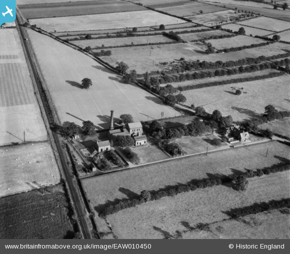
EAW010450 ENGLAND (1947). Farnsfield Water Pumping Station, Farnsfield, 1947
© Copyright OpenStreetMap contributors and licensed by the OpenStreetMap Foundation. 2026. Cartography is licensed as CC BY-SA.
Nearby Images (5)
EAW010450

EAW010449

EAW010447

EAW010448

EAW007334

Details
| Title | [EAW010450] Farnsfield Water Pumping Station, Farnsfield, 1947 |
| Reference | EAW010450 |
| Date | 30-August-1947 |
| Link | |
| Place name | FARNSFIELD |
| Parish | FARNSFIELD |
| District | |
| Country | ENGLAND |
| Easting / Northing | 465584, 356747 |
| Longitude / Latitude | -1.02029040223, 53.103586399793 |
| National Grid Reference | SK656567 |
Pins
Be the first to add a comment to this image!