
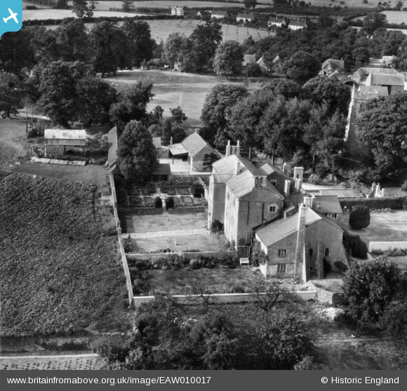
EAW010017 ENGLAND (1947). Ebrington Manor, Ebrington, 1947
© Copyright OpenStreetMap contributors and licensed by the OpenStreetMap Foundation. 2026. Cartography is licensed as CC BY-SA.
Nearby Images (17)
EAW010017

EAW006904

EAW006906

EAW006909

EAW006908

EAW010018

EAW006910

EAW006905

EAW006907

EAW006903

EAW006902

EAW010019

EAW010020

EAW010015

EAW010016

EAW010022

EAW010021

Details
| Title | [EAW010017] Ebrington Manor, Ebrington, 1947 |
| Reference | EAW010017 |
| Date | 29-August-1947 |
| Link | |
| Place name | EBRINGTON |
| Parish | EBRINGTON |
| District | |
| Country | ENGLAND |
| Easting / Northing | 418327, 239951 |
| Longitude / Latitude | -1.7326724001018, 52.057219122485 |
| National Grid Reference | SP183400 |
Pins
Be the first to add a comment to this image!
User Comment Contributions

Ebrington Manor and St. Eadburgha's Church, Ebrington, 08/06/2016 |

Class31 |
Wednesday 8th of June 2016 09:57:01 PM |