
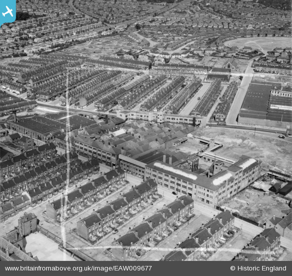
EAW009677 ENGLAND (1947). A. Kershaw and Sons Works, Leeds, 1947. This image was marked by Aerofilms Ltd for photo editing.
© Copyright OpenStreetMap contributors and licensed by the OpenStreetMap Foundation. 2025. Cartography is licensed as CC BY-SA.
Nearby Images (17)
EAW009677

EAW015982

EAW009678

EAW009676

EAW009682

EAW009683

EAW009679

EAW015985

EAW009680

EAW009685

EAW009681

EAW009684

EAW015983

EAW015981

EAW015984

EPW024324

EPW024319

Details
| Title | [EAW009677] A. Kershaw and Sons Works, Leeds, 1947. This image was marked by Aerofilms Ltd for photo editing. |
| Reference | EAW009677 |
| Date | 1-September-1947 |
| Link | |
| Place name | LEEDS |
| Parish | |
| District | |
| Country | ENGLAND |
| Easting / Northing | 432094, 435270 |
| Longitude / Latitude | -1.5125243995438, 53.812511537962 |
| National Grid Reference | SE321353 |

