
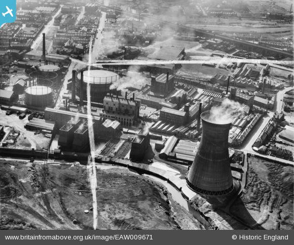
EAW009671 ENGLAND (1947). Textile mills between Leeds Road and St Andrew's Road, Huddersfield, 1947. This image was marked by Aerofilms Ltd for photo editing.
© Copyright OpenStreetMap contributors and licensed by the OpenStreetMap Foundation. 2026. Cartography is licensed as CC BY-SA.
Nearby Images (12)
EAW009671

EAW009688

EAW009672

EAW009689

EAW009686

EAW009670

EAW009687

EAW009674

EAW009675

EAW009668

EAW009673

EAW009669

Details
| Title | [EAW009671] Textile mills between Leeds Road and St Andrew's Road, Huddersfield, 1947. This image was marked by Aerofilms Ltd for photo editing. |
| Reference | EAW009671 |
| Date | 1-September-1947 |
| Link | |
| Place name | HUDDERSFIELD |
| Parish | |
| District | |
| Country | ENGLAND |
| Easting / Northing | 415022, 417420 |
| Longitude / Latitude | -1.7726946087913, 53.652830687359 |
| National Grid Reference | SE150174 |
