
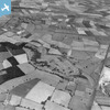
EAW009491 ENGLAND (1947). Rushcliffe Golf Course, Gotham, 1947. This image has been produced from a print.

© Copyright OpenStreetMap contributors and licensed by the OpenStreetMap Foundation. 2026. Cartography is licensed as CC BY-SA.
Nearby Images (2)
EAW009491
 0°
0m
0°
0m
EAW009493
 172°
238m
172°
238m
Details
| Title | [EAW009491] Rushcliffe Golf Course, Gotham, 1947. This image has been produced from a print. |
| Reference | EAW009491 |
| Date | 19-August-1947 |
| Link | |
| Place name | GOTHAM |
| Parish | GOTHAM |
| District | |
| Country | ENGLAND |
| Easting / Northing | 454556, 328417 |
| Longitude / Latitude | -1.189787126949, 52.85015992852 |
| National Grid Reference | SK546284 |
Pins
 Branch line from the main GC line (on the right) leading to the British Gypsum works on the left, including a Level Crossing at Leake Road. Branch line from the main GC line (on the right) leading to the British Gypsum works on the left, including a Level Crossing at Leake Road. |

KC |
Sunday 10th of April 2022 12:48:30 PM |
| Ex Great Central railways "Rushcliffe Platform" on their London Extension line. |
John Wass |
Saturday 12th of December 2015 07:33:06 PM |