
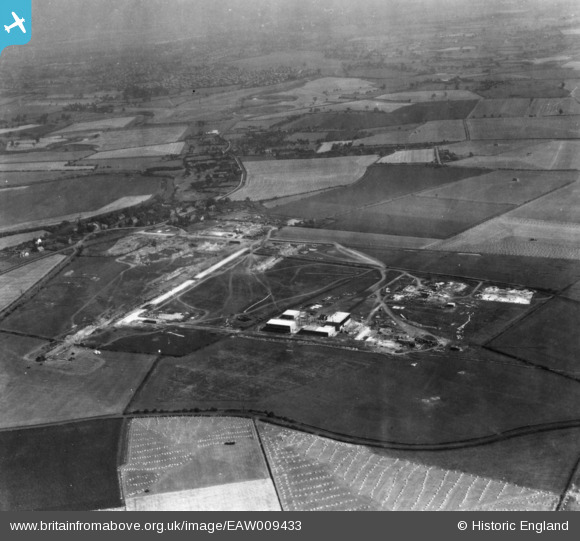
EAW009433 ENGLAND (1947). Petrochemicals Plant under construction, Carrington, 1947. This image has been produced from a print.
© Copyright OpenStreetMap contributors and licensed by the OpenStreetMap Foundation. 2026. Cartography is licensed as CC BY-SA.
Nearby Images (8)
EAW009433

EAW009434

EAW009443

EAW009444

EAW009440

EAW009447

EAW009429

EAW009446

Details
| Title | [EAW009433] Petrochemicals Plant under construction, Carrington, 1947. This image has been produced from a print. |
| Reference | EAW009433 |
| Date | 20-August-1947 |
| Link | |
| Place name | CARRINGTON |
| Parish | CARRINGTON |
| District | |
| Country | ENGLAND |
| Easting / Northing | 373863, 392536 |
| Longitude / Latitude | -2.3934092220074, 53.428706374455 |
| National Grid Reference | SJ739925 |
Pins

redmist |
Saturday 5th of January 2019 06:56:08 PM | |
|
redmist |
Saturday 5th of January 2019 06:54:14 PM | |
|
parrot |
Thursday 26th of January 2017 02:35:14 PM | |
|
parrot |
Monday 23rd of January 2017 11:27:27 AM | |
|
parrot |
Monday 23rd of January 2017 11:26:27 AM |