
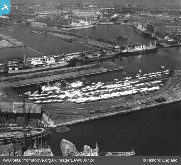
EAW009424 ENGLAND (1947). The docks, Hartlepool, 1947. This image has been produced from a print.
© Copyright OpenStreetMap contributors and licensed by the OpenStreetMap Foundation. 2026. Cartography is licensed as CC BY-SA.
Nearby Images (6)
EAW009424

EAW009423

EAW695745

EPW010607

EPW010605

EPW010606

Details
| Title | [EAW009424] The docks, Hartlepool, 1947. This image has been produced from a print. |
| Reference | EAW009424 |
| Date | 17-August-1947 |
| Link | |
| Place name | HARTLEPOOL |
| Parish | |
| District | |
| Country | ENGLAND |
| Easting / Northing | 451414, 533280 |
| Longitude / Latitude | -1.2022772978617, 54.691823103362 |
| National Grid Reference | NZ514333 |
Pins

J May |
Thursday 12th of November 2015 09:18:28 AM | |
|
Applecounty |
Monday 6th of October 2014 04:14:33 PM |