
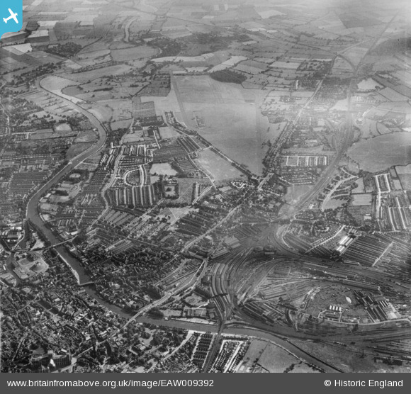
EAW009392 ENGLAND (1947). York Racecourse, the Railway Station and South Bank, York, 1947
© Copyright OpenStreetMap contributors and licensed by the OpenStreetMap Foundation. 2026. Cartography is licensed as CC BY-SA.
Nearby Images (2)
EAW009392

EAW009391

Details
| Title | [EAW009392] York Racecourse, the Railway Station and South Bank, York, 1947 |
| Reference | EAW009392 |
| Date | 17-August-1947 |
| Link | |
| Place name | YORK |
| Parish | |
| District | |
| Country | ENGLAND |
| Easting / Northing | 459566, 450776 |
| Longitude / Latitude | -1.0922826755279, 53.949454513108 |
| National Grid Reference | SE596508 |
Pins

redmist |
Sunday 14th of November 2021 08:09:11 PM | |
|
redmist |
Thursday 1st of November 2018 11:30:27 PM | |
Tegels |
Monday 11th of August 2014 03:05:32 PM | |
|
Tegels |
Monday 11th of August 2014 03:04:43 PM |