
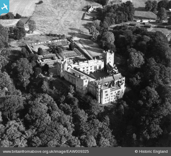
EAW009325 ENGLAND (1947). Naworth Castle, Brampton, 1947. This image has been produced from a print.
© Copyright OpenStreetMap contributors and licensed by the OpenStreetMap Foundation. 2026. Cartography is licensed as CC BY-SA.
Nearby Images (9)
EAW009325

EAW009327

EAW009326

EAW009329

EAW009328

EAW009324

EAW014510

EAW014511

EAW014509

Details
| Title | [EAW009325] Naworth Castle, Brampton, 1947. This image has been produced from a print. |
| Reference | EAW009325 |
| Date | 11-August-1947 |
| Link | |
| Place name | BRAMPTON |
| Parish | BRAMPTON |
| District | |
| Country | ENGLAND |
| Easting / Northing | 355981, 562609 |
| Longitude / Latitude | -2.6874569794727, 54.956098867507 |
| National Grid Reference | NY560626 |
Pins

redmist |
Sunday 2nd of August 2020 10:54:34 PM |