
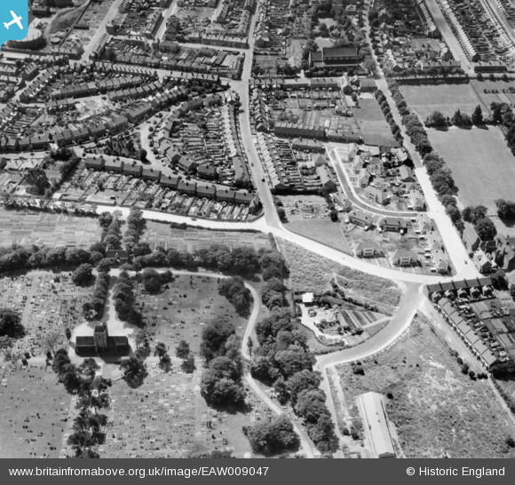
EAW009047 ENGLAND (1947). The residential area surrounding Dane Crescent and Holly Road, Ramsgate, 1947
© Copyright OpenStreetMap contributors and licensed by the OpenStreetMap Foundation. 2026. Cartography is licensed as CC BY-SA.
Nearby Images (4)
EAW009047

EAW009028

EAW009048

EAW009046

Details
| Title | [EAW009047] The residential area surrounding Dane Crescent and Holly Road, Ramsgate, 1947 |
| Reference | EAW009047 |
| Date | 12-August-1947 |
| Link | |
| Place name | RAMSGATE |
| Parish | RAMSGATE |
| District | |
| Country | ENGLAND |
| Easting / Northing | 638245, 165942 |
| Longitude / Latitude | 1.4212579441411, 51.342044648531 |
| National Grid Reference | TR382659 |
Pins
Be the first to add a comment to this image!