
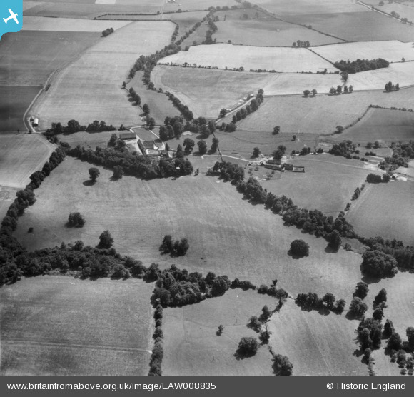
EAW008835 ENGLAND (1947). Little Baldon Farm and surrounding fields, Marsh Baldon, 1947
© Copyright OpenStreetMap contributors and licensed by the OpenStreetMap Foundation. 2025. Cartography is licensed as CC BY-SA.
Nearby Images (11)
EAW008835

EAW008844

EAW008842

EAW008829

EAW008840

EAW008839

EAW008836

EAW008827

EAW008828

EAW008843

EAW008837

Details
| Title | [EAW008835] Little Baldon Farm and surrounding fields, Marsh Baldon, 1947 |
| Reference | EAW008835 |
| Date | 9-August-1947 |
| Link | |
| Place name | MARSH BALDON |
| Parish | MARSH BALDON |
| District | |
| Country | ENGLAND |
| Easting / Northing | 456668, 198613 |
| Longitude / Latitude | -1.1802368306275, 51.682953398394 |
| National Grid Reference | SU567986 |
Pins
Be the first to add a comment to this image!