
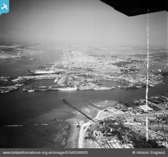
EAW008805 ENGLAND (1947). The docks and the city, Southampton, from the south-east, 1947. This image was marked by Aerofilms Ltd for photo editing.
© Copyright OpenStreetMap contributors and licensed by the OpenStreetMap Foundation. 2026. Cartography is licensed as CC BY-SA.
Nearby Images (3)
EAW008805

EAW033410

EPW009084

Details
| Title | [EAW008805] The docks and the city, Southampton, from the south-east, 1947. This image was marked by Aerofilms Ltd for photo editing. |
| Reference | EAW008805 |
| Date | 9-August-1947 |
| Link | |
| Place name | SOUTHAMPTON |
| Parish | |
| District | |
| Country | ENGLAND |
| Easting / Northing | 443316, 110275 |
| Longitude / Latitude | -1.3840921164158, 50.889780088666 |
| National Grid Reference | SU433103 |
Pins

Matt Aldred edob.mattaldred.com |
Sunday 20th of July 2025 10:53:33 AM | |

chainbull |
Sunday 3rd of August 2014 07:55:54 PM | |
|
chainbull |
Sunday 3rd of August 2014 07:54:38 PM |