
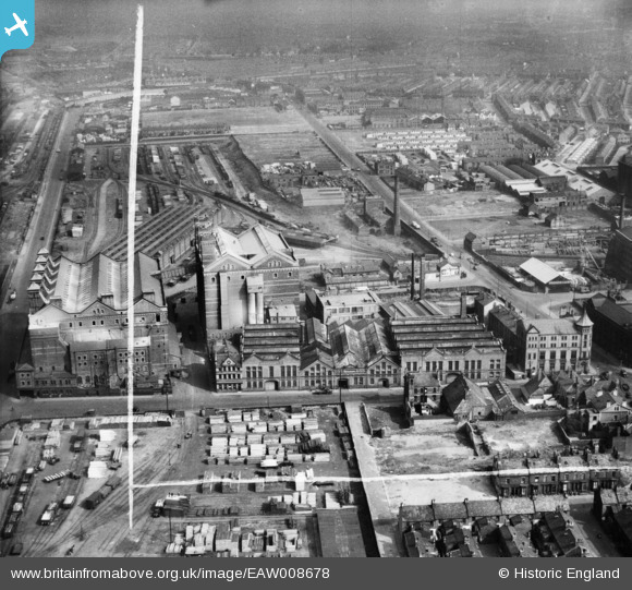
EAW008678 ENGLAND (1947). Harland and Wolff Buildings on Strand Road, Alexandra Warehouse (No. 2) and environs, Bootle, 1947. This image was marked by Aerofilms Ltd for photo editing.
© Copyright OpenStreetMap contributors and licensed by the OpenStreetMap Foundation. 2026. Cartography is licensed as CC BY-SA.
Nearby Images (11)
EAW008678
 and environs, Bootle, 1947. This image was marked by Aerofilms Ltd for photo editing.")
EAW008682
 and environs, Bootle, 1947")
EAW008684
 and environs, Bootle, 1947. This image was marked by Aerofilms Ltd for photo editing.")
EAW008683
 and environs, Bootle, 1947. This image was marked by Aerofilms Ltd for photo editing.")
EAW008688

EAW008681
 and environs, Bootle, 1947. This image was marked by Aerofilms Ltd for photo editing.")
EAW008672
 and environs, Bootle, 1947")
EAW008668

EAW008670

EAW008687

EAW008669

Details
| Title | [EAW008678] Harland and Wolff Buildings on Strand Road, Alexandra Warehouse (No. 2) and environs, Bootle, 1947. This image was marked by Aerofilms Ltd for photo editing. |
| Reference | EAW008678 |
| Date | 1-August-1947 |
| Link | |
| Place name | BOOTLE |
| Parish | |
| District | |
| Country | ENGLAND |
| Easting / Northing | 333404, 395349 |
| Longitude / Latitude | -3.0029145252065, 53.45043245624 |
| National Grid Reference | SJ334953 |
Pins

redmist |
Friday 12th of February 2021 04:42:12 PM |