
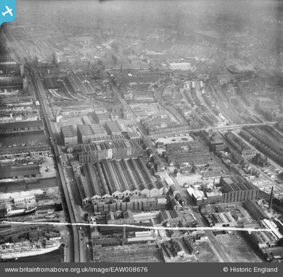
EAW008676 ENGLAND (1947). The Harland and Wolff Shipbuilding and Engineering Works, Bootle, from the south, 1947. This image was marked by Aerofilms Ltd for photo editing.
© Copyright OpenStreetMap contributors and licensed by the OpenStreetMap Foundation. 2026. Cartography is licensed as CC BY-SA.
Nearby Images (10)
EAW008676

EAW008675

EAW008686

EAW008679

EAW008674

EAW008673

EAW008680

EAW008685

EAW008677

EPW051523

Details
| Title | [EAW008676] The Harland and Wolff Shipbuilding and Engineering Works, Bootle, from the south, 1947. This image was marked by Aerofilms Ltd for photo editing. |
| Reference | EAW008676 |
| Date | 1-August-1947 |
| Link | |
| Place name | BOOTLE |
| Parish | |
| District | |
| Country | ENGLAND |
| Easting / Northing | 333761, 394338 |
| Longitude / Latitude | -2.9973262386172, 53.441390411287 |
| National Grid Reference | SJ338943 |
Pins

john |
Sunday 1st of February 2026 11:25:55 AM | |
|
Lord Axminister |
Monday 14th of July 2025 09:01:21 PM | |
|
Lord Axminister |
Monday 14th of July 2025 08:59:00 PM | |
|
Lord Axminister |
Monday 14th of July 2025 08:56:49 PM | |
|
Bashey |
Wednesday 18th of January 2023 11:00:49 PM | |
|
redmist |
Friday 12th of February 2021 04:44:22 PM | |
|
bob |
Monday 29th of June 2020 08:27:33 AM |
