
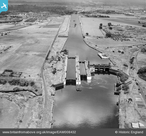
EAW008432 ENGLAND (1947). Barton Locks and sluices on the Manchester Ship Canal, Barton Locks, 1947
© Copyright OpenStreetMap contributors and licensed by the OpenStreetMap Foundation. 2026. Cartography is licensed as CC BY-SA.
Nearby Images (3)
EAW008432

EPW042577

EPW042578

Details
| Title | [EAW008432] Barton Locks and sluices on the Manchester Ship Canal, Barton Locks, 1947 |
| Reference | EAW008432 |
| Date | 22-July-1947 |
| Link | |
| Place name | BARTON LOCKS |
| Parish | |
| District | |
| Country | ENGLAND |
| Easting / Northing | 374825, 396582 |
| Longitude / Latitude | -2.3792535489267, 53.465124073834 |
| National Grid Reference | SJ748966 |
Pins

Saul |
Saturday 28th of October 2023 04:11:00 PM | |
|
Michael Woolf |
Thursday 2nd of March 2023 05:25:39 PM | |
|
Stretfordian |
Thursday 29th of September 2022 11:29:06 AM | |
|
redmist |
Sunday 6th of January 2019 10:53:37 PM | |
Hi,seeing your interest in WW2,any idea what this feature is.Below and to the right of the pin "Weast Cemetary"is a large circle reminicent of a heavy AA Battery\ https://britainfromabove.org.uk/en/image/EAW006236 |
boltie |
Thursday 31st of December 2020 03:59:50 PM |