
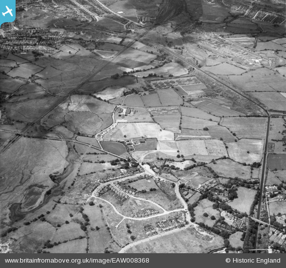
EAW008368 ENGLAND (1947). Newton village, the Ray Hall Sewage Works and the Tame Valley Canal, West Bromwich, from the south-east, 1947
© Copyright OpenStreetMap contributors and licensed by the OpenStreetMap Foundation. 2026. Cartography is licensed as CC BY-SA.
Nearby Images (2)
EAW008368

EAW008369

Details
| Title | [EAW008368] Newton village, the Ray Hall Sewage Works and the Tame Valley Canal, West Bromwich, from the south-east, 1947 |
| Reference | EAW008368 |
| Date | 20-July-1947 |
| Link | |
| Place name | WEST BROMWICH |
| Parish | |
| District | |
| Country | ENGLAND |
| Easting / Northing | 403171, 293853 |
| Longitude / Latitude | -1.9532380809244, 52.542161168569 |
| National Grid Reference | SP032939 |
Pins

redmist |
Thursday 28th of October 2021 07:21:06 PM | |
|
redmist |
Thursday 28th of October 2021 07:19:57 PM | |
|
Hamilton163 |
Sunday 18th of October 2015 10:01:08 PM | |
|
Hamilton163 |
Sunday 18th of October 2015 10:00:18 PM | |
|
Hamilton163 |
Sunday 18th of October 2015 09:59:15 PM | |
|
Hamilton163 |
Sunday 18th of October 2015 09:55:53 PM | |
|
Hamilton163 |
Sunday 18th of October 2015 09:54:06 PM | |
|
Hamilton163 |
Sunday 18th of October 2015 09:52:58 PM |
User Comment Contributions
My Dad used to work at Ray Hall during the 1960's, and the area round about was the "stamping ground" of my youth. As a boy my Mom used to pack a picnic, and we would spend an afternoon sitting in some of the picturesque countryside now long since bulldozed and built upon. |
DUFTY |
Saturday 21st of December 2013 05:46:55 PM |