
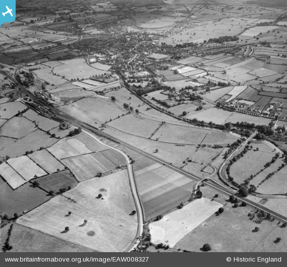
EAW008327 ENGLAND (1947). The River Trent and the Trent and Mersey Canal, Rugeley, from the north, 1947
© Copyright OpenStreetMap contributors and licensed by the OpenStreetMap Foundation. 2026. Cartography is licensed as CC BY-SA.
Nearby Images (3)
EAW008327

EAW008322

EAW008328

Details
| Title | [EAW008327] The River Trent and the Trent and Mersey Canal, Rugeley, from the north, 1947 |
| Reference | EAW008327 |
| Date | 20-July-1947 |
| Link | |
| Place name | RUGELEY |
| Parish | RUGELEY |
| District | |
| Country | ENGLAND |
| Easting / Northing | 404323, 319295 |
| Longitude / Latitude | -1.9359162280605, 52.770895478565 |
| National Grid Reference | SK043193 |
Pins

PURCELL |
Saturday 17th of May 2014 10:16:41 AM | |
|
PURCELL |
Saturday 17th of May 2014 10:15:30 AM | |
|
PURCELL |
Saturday 17th of May 2014 10:14:51 AM | |
|
PURCELL |
Saturday 17th of May 2014 10:14:08 AM | |
|
PURCELL |
Saturday 17th of May 2014 10:13:09 AM | |
|
PURCELL |
Saturday 17th of May 2014 10:12:27 AM | |
|
PURCELL |
Saturday 17th of May 2014 10:11:47 AM | |
|
PURCELL |
Saturday 17th of May 2014 10:11:10 AM |