
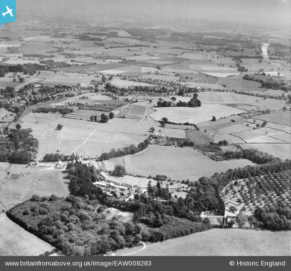
EAW008283 ENGLAND (1947). The Grosvenor Sanatorium and the surrounding countryside, Bockhanger, from the north-west, 1947
© Copyright OpenStreetMap contributors and licensed by the OpenStreetMap Foundation. 2026. Cartography is licensed as CC BY-SA.
Nearby Images (7)
EAW008283

EAW008291

EAW008285

EAW008284

EAW008286

EAW008288

EAW008289

Details
| Title | [EAW008283] The Grosvenor Sanatorium and the surrounding countryside, Bockhanger, from the north-west, 1947 |
| Reference | EAW008283 |
| Date | 15-July-1947 |
| Link | |
| Place name | BOCKHANGER |
| Parish | |
| District | |
| Country | ENGLAND |
| Easting / Northing | 601030, 144874 |
| Longitude / Latitude | 0.87579546389987, 51.167204921383 |
| National Grid Reference | TR010449 |
Pins
Be the first to add a comment to this image!