
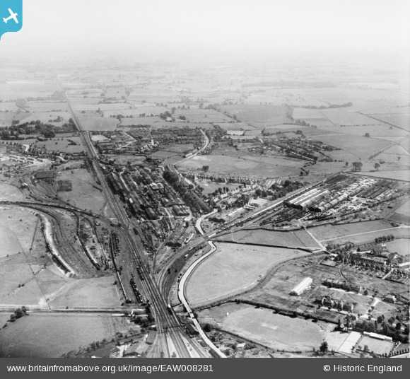
EAW008281 ENGLAND (1947). The Southern Railway Works, Ashford, from the north-west, 1947
© Copyright OpenStreetMap contributors and licensed by the OpenStreetMap Foundation. 2026. Cartography is licensed as CC BY-SA.
Nearby Images (4)
EAW008281

EAW008282

EPW026060

EPW000521

Details
| Title | [EAW008281] The Southern Railway Works, Ashford, from the north-west, 1947 |
| Reference | EAW008281 |
| Date | 15-July-1947 |
| Link | |
| Place name | ASHFORD |
| Parish | |
| District | |
| Country | ENGLAND |
| Easting / Northing | 601367, 141931 |
| Longitude / Latitude | 0.87896309432385, 51.140653320494 |
| National Grid Reference | TR014419 |
Pins

B.R.E.L.I.E. |
Monday 5th of January 2015 09:19:25 PM | |
|
B.R.E.L.I.E. |
Monday 1st of September 2014 04:25:01 PM | |
|
B.R.E.L.I.E. |
Monday 1st of September 2014 04:18:36 PM | |
|
B.R.E.L.I.E. |
Monday 1st of September 2014 04:11:06 PM | |
|
B.R.E.L.I.E. |
Sunday 6th of April 2014 08:56:48 PM | |
|
B.R.E.L.I.E. |
Sunday 6th of April 2014 08:54:02 PM | |
|
B.R.E.L.I.E. |
Sunday 6th of April 2014 08:52:26 PM |