
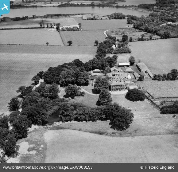
EAW008153 ENGLAND (1947). Thrigby Hall, Hall Farm and environs, Thrigby, 1947
© Copyright OpenStreetMap contributors and licensed by the OpenStreetMap Foundation. 2026. Cartography is licensed as CC BY-SA.
Nearby Images (15)
EAW008153

EAW008154

EAW008143

EAW008148

EAW008150

EAW008145

EAW008152

EAW008146

EAW008147

EAW008156

EAW008144

EAW008149

EAW008151

EAW008157

EAW008155

Details
| Title | [EAW008153] Thrigby Hall, Hall Farm and environs, Thrigby, 1947 |
| Reference | EAW008153 |
| Date | 12-July-1947 |
| Link | |
| Place name | THRIGBY |
| Parish | MAUTBY |
| District | |
| Country | ENGLAND |
| Easting / Northing | 646095, 312429 |
| Longitude / Latitude | 1.6389394286931, 52.653293929826 |
| National Grid Reference | TG461124 |
Pins
Be the first to add a comment to this image!