
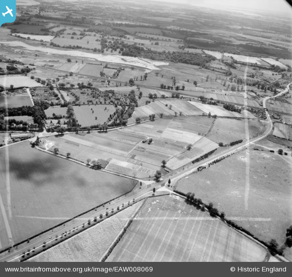
EAW008069 ENGLAND (1947). The A12, Ipswich Road and environs, Martlesham, from the north-west, 1947. This image was marked by Aerofilms Ltd for photo editing.
© Copyright OpenStreetMap contributors and licensed by the OpenStreetMap Foundation. 2026. Cartography is licensed as CC BY-SA.
Nearby Images (5)
EAW008069

EAW008068

EAW008067

EAW008066

EAW008070

Details
| Title | [EAW008069] The A12, Ipswich Road and environs, Martlesham, from the north-west, 1947. This image was marked by Aerofilms Ltd for photo editing. |
| Reference | EAW008069 |
| Date | 12-July-1947 |
| Link | |
| Place name | MARTLESHAM |
| Parish | MARTLESHAM |
| District | |
| Country | ENGLAND |
| Easting / Northing | 625616, 248275 |
| Longitude / Latitude | 1.2935403473107, 52.08634592492 |
| National Grid Reference | TM256483 |
Pins

Matt Aldred edob.mattaldred.com |
Sunday 2nd of March 2025 02:23:57 PM | |
|
Matt Aldred edob.mattaldred.com |
Sunday 2nd of March 2025 02:23:28 PM | |
|
Matt Aldred edob.mattaldred.com |
Thursday 11th of March 2021 05:46:56 PM | |
|
Matt Aldred edob.mattaldred.com |
Thursday 11th of March 2021 05:44:45 PM | |

Sparky |
Monday 2nd of October 2017 09:48:38 PM | |
|
Sparky |
Monday 2nd of October 2017 09:47:46 PM | |
|
Sparky |
Monday 2nd of October 2017 09:46:44 PM | |

Graham Yaxley |
Wednesday 4th of March 2015 03:20:38 PM |