
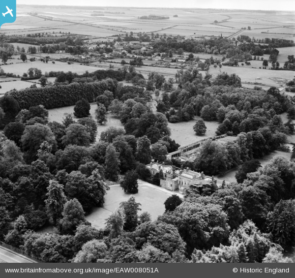
EAW008051A ENGLAND (1947). Hinxton Hall and environs, Hinxton, from the north-east, 1947
© Copyright OpenStreetMap contributors and licensed by the OpenStreetMap Foundation. 2026. Cartography is licensed as CC BY-SA.
Nearby Images (9)
EAW008051A

EAW008052

EAW008054

EAW008053

EAW008055

EAW008057

EAW008056

EAW008060

EAW008059

Details
| Title | [EAW008051A] Hinxton Hall and environs, Hinxton, from the north-east, 1947 |
| Reference | EAW008051A |
| Date | 12-July-1947 |
| Link | |
| Place name | HINXTON |
| Parish | HINXTON |
| District | |
| Country | ENGLAND |
| Easting / Northing | 549818, 244829 |
| Longitude / Latitude | 0.18662058724446, 52.081100683895 |
| National Grid Reference | TL498448 |
Pins

Matt Aldred edob.mattaldred.com |
Sunday 8th of November 2020 03:57:45 PM |