
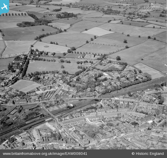
EAW008041 ENGLAND (1947). Wrekin College and environs, Wellington, 1947
© Copyright OpenStreetMap contributors and licensed by the OpenStreetMap Foundation. 2026. Cartography is licensed as CC BY-SA.
Nearby Images (5)
EAW008041

EPW034034

EAW008047

EAW008046

EPW034032

Details
| Title | [EAW008041] Wrekin College and environs, Wellington, 1947 |
| Reference | EAW008041 |
| Date | 30-May-1947 |
| Link | |
| Place name | WELLINGTON |
| Parish | WELLINGTON |
| District | |
| Country | ENGLAND |
| Easting / Northing | 365546, 311755 |
| Longitude / Latitude | -2.5099405069771, 52.702026954023 |
| National Grid Reference | SJ655118 |
Pins
Be the first to add a comment to this image!