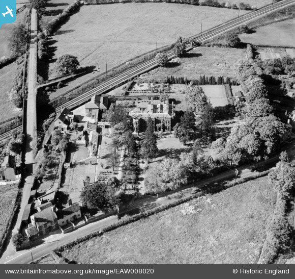
EAW008020 ENGLAND (1947). Haybridge Hall, Haybridge, 1947
© Copyright OpenStreetMap contributors and licensed by the OpenStreetMap Foundation. 2025. Cartography is licensed as CC BY-SA.
Details
| Title | [EAW008020] Haybridge Hall, Haybridge, 1947 |
| Reference | EAW008020 |
| Date | 30-May-1947 |
| Link | |
| Place name | HAYBRIDGE |
| Parish | HADLEY & LEEGOMERY |
| District | |
| Country | ENGLAND |
| Easting / Northing | 366600, 311668 |
| Longitude / Latitude | -2.4943324601205, 52.701310859276 |
| National Grid Reference | SJ666117 |
Pins
 MB |
Wednesday 13th of November 2013 10:47:42 AM |


![[EAW008020] Haybridge Hall, Haybridge, 1947](http://britainfromabove.org.uk/sites/all/libraries/aerofilms-images/public/100x100/EAW/008/EAW008020.jpg)
![[EAW008018] Haybridge Hall, Haybridge, 1947](http://britainfromabove.org.uk/sites/all/libraries/aerofilms-images/public/100x100/EAW/008/EAW008018.jpg)
![[EAW008019] Haybridge Hall, Haybridge, 1947](http://britainfromabove.org.uk/sites/all/libraries/aerofilms-images/public/100x100/EAW/008/EAW008019.jpg)