
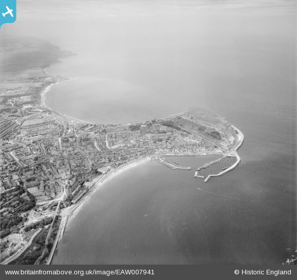
EAW007941 ENGLAND (1947). North Bay and the headland, Scarborough, from the south, 1947
© Copyright OpenStreetMap contributors and licensed by the OpenStreetMap Foundation. 2026. Cartography is licensed as CC BY-SA.
Nearby Images (8)
EAW007941

EAW007948

EAW016694

EAW016688

EAW016690

EPW029089

EAW016689

EAW016692

Details
| Title | [EAW007941] North Bay and the headland, Scarborough, from the south, 1947 |
| Reference | EAW007941 |
| Date | 26-June-1947 |
| Link | |
| Place name | SCARBOROUGH |
| Parish | |
| District | |
| Country | ENGLAND |
| Easting / Northing | 504829, 488412 |
| Longitude / Latitude | -0.38970360718349, 54.2804247911 |
| National Grid Reference | TA048884 |
Pins

redmist |
Thursday 12th of September 2019 08:07:56 PM | |
|
redmist |
Thursday 12th of September 2019 08:05:47 PM | |
|
Tom |
Friday 23rd of February 2018 05:02:44 PM | |
|
trevorsboy |
Tuesday 22nd of March 2016 05:19:35 PM | |

Alan McFaden |
Thursday 9th of January 2014 11:42:25 AM | |
|
Alan McFaden |
Thursday 9th of January 2014 11:41:42 AM | |
|
Alan McFaden |
Thursday 9th of January 2014 11:41:12 AM | |
|
Alan McFaden |
Thursday 9th of January 2014 11:40:44 AM |


