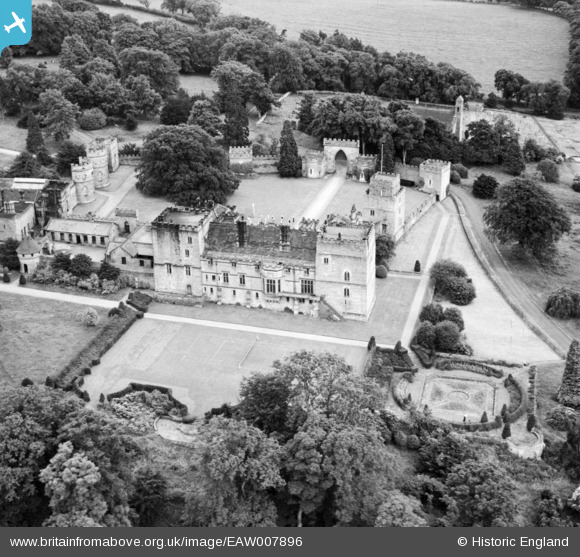
EAW007896 ENGLAND (1947). Ford Castle, Ford, 1947
© Copyright OpenStreetMap contributors and licensed by the OpenStreetMap Foundation. 2026. Cartography is licensed as CC BY-SA.
Nearby Images (8)
Details
| Title | [EAW007896] Ford Castle, Ford, 1947 |
| Reference | EAW007896 |
| Date | 27-June-1947 |
| Link | |
| Place name | FORD |
| Parish | FORD |
| District | |
| Country | ENGLAND |
| Easting / Northing | 394399, 637539 |
| Longitude / Latitude | -2.0889697050428, 55.631389445923 |
| National Grid Reference | NT944375 |
Pins
Be the first to add a comment to this image!


![[EAW007896] Ford Castle, Ford, 1947](http://britainfromabove.org.uk/sites/all/libraries/aerofilms-images/public/100x100/EAW/007/EAW007896.jpg)
![[EAW007898] King James's Tower and Ford Castle, Ford, 1947](http://britainfromabove.org.uk/sites/all/libraries/aerofilms-images/public/100x100/EAW/007/EAW007898.jpg)
![[EAW007897] Ford Castle, Ford, 1947. This image has been produced from a print.](http://britainfromabove.org.uk/sites/all/libraries/aerofilms-images/public/100x100/EAW/007/EAW007897.jpg)
![[EAW007894] Ford Castle, Ford, 1947](http://britainfromabove.org.uk/sites/all/libraries/aerofilms-images/public/100x100/EAW/007/EAW007894.jpg)
![[EAW007893] Ford Castle, Ford, 1947. This image has been produced from a print.](http://britainfromabove.org.uk/sites/all/libraries/aerofilms-images/public/100x100/EAW/007/EAW007893.jpg)
![[EAW007900] Ford Castle, Ford, 1947](http://britainfromabove.org.uk/sites/all/libraries/aerofilms-images/public/100x100/EAW/007/EAW007900.jpg)
![[EAW007901] Ford Castle, Ford, 1947. This image has been produced from a print.](http://britainfromabove.org.uk/sites/all/libraries/aerofilms-images/public/100x100/EAW/007/EAW007901.jpg)
![[EAW007899] Ford Castle, Ford, 1947](http://britainfromabove.org.uk/sites/all/libraries/aerofilms-images/public/100x100/EAW/007/EAW007899.jpg)