
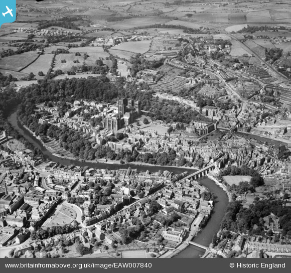
EAW007840 ENGLAND (1947). The historic city centre, Durham, from the north-east, 1947
© Copyright OpenStreetMap contributors and licensed by the OpenStreetMap Foundation. 2026. Cartography is licensed as CC BY-SA.
Nearby Images (3)
EAW007840

EAW017415

EAW017414

Details
| Title | [EAW007840] The historic city centre, Durham, from the north-east, 1947 |
| Reference | EAW007840 |
| Date | 27-June-1947 |
| Link | |
| Place name | DURHAM |
| Parish | |
| District | |
| Country | ENGLAND |
| Easting / Northing | 427716, 542302 |
| Longitude / Latitude | -1.5690916436289, 54.774769329722 |
| National Grid Reference | NZ277423 |
Pins

Ebo77 |
Friday 22nd of May 2020 06:25:46 PM | |
|
Val |
Thursday 4th of October 2018 04:03:48 PM | |
|
Porcy |
Thursday 22nd of June 2017 01:55:47 PM | |
|
Porcy |
Thursday 22nd of June 2017 01:54:55 PM | |
|
Porcy |
Thursday 22nd of June 2017 01:52:22 PM | |
|
Porcy |
Thursday 22nd of June 2017 01:50:47 PM | |
|
Porcy |
Thursday 22nd of June 2017 01:49:59 PM | |
|
Porcy |
Thursday 22nd of June 2017 01:48:44 PM | |
|
billandjm |
Monday 30th of June 2014 08:24:04 PM | |
|
billandjm |
Monday 30th of June 2014 08:10:57 PM | |

Class31 |
Thursday 8th of May 2014 08:43:11 PM | |
|
anwyn |
Tuesday 3rd of December 2013 03:12:14 PM | |
|
anwyn |
Tuesday 3rd of December 2013 03:10:56 PM | |
|
anwyn |
Tuesday 3rd of December 2013 03:02:00 PM |
User Comment Contributions
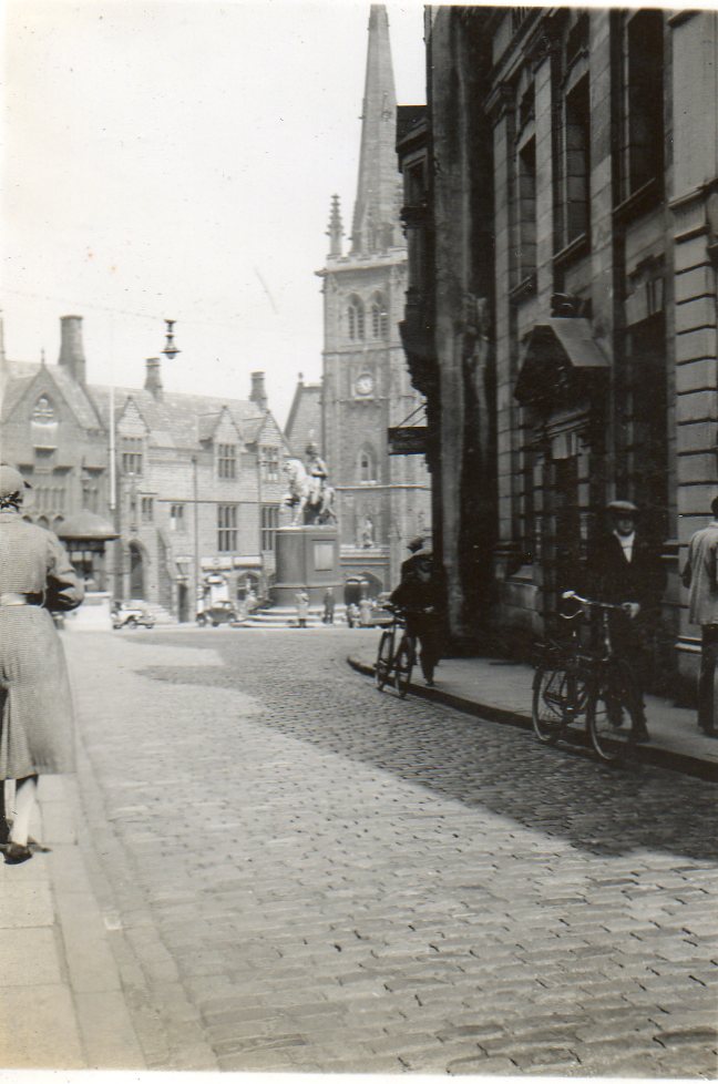
An original period photograph entitled "Market Place from Saddler Street." taken June or July 1939 |
Class31 |
Tuesday 6th of May 2014 03:18:45 PM |