
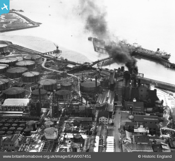
EAW007451 ENGLAND (1947). Part of the Coryton Oil Refinery complex, Coryton, 1947. This image has been produced from a print.
© Copyright OpenStreetMap contributors and licensed by the OpenStreetMap Foundation. 2026. Cartography is licensed as CC BY-SA.
Nearby Images (12)
EAW007451

EAW007461

EAW007456

EAW007453

EAW043879

EAW007457

EAW007449

EAW007460

EAW007462

EAW007450

EAW007464

EAW047430

Details
| Title | [EAW007451] Part of the Coryton Oil Refinery complex, Coryton, 1947. This image has been produced from a print. |
| Reference | EAW007451 |
| Date | 25-June-1947 |
| Link | |
| Place name | CORYTON |
| Parish | |
| District | |
| Country | ENGLAND |
| Easting / Northing | 574482, 181751 |
| Longitude / Latitude | 0.51450874573296, 51.507229600385 |
| National Grid Reference | TQ745818 |
Pins
Be the first to add a comment to this image!