
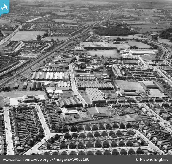
EAW007189 ENGLAND (1947). The Perivale Industrial Park, Perivale, 1947
© Copyright OpenStreetMap contributors and licensed by the OpenStreetMap Foundation. 2026. Cartography is licensed as CC BY-SA.
Nearby Images (5)
EAW007189

EAW007191

EPR000614

EPW040835

EPW035534

Details
| Title | [EAW007189] The Perivale Industrial Park, Perivale, 1947 |
| Reference | EAW007189 |
| Date | June-1947 |
| Link | |
| Place name | PERIVALE |
| Parish | |
| District | |
| Country | ENGLAND |
| Easting / Northing | 517178, 183284 |
| Longitude / Latitude | -0.31032463904776, 51.535803020676 |
| National Grid Reference | TQ172833 |
Pins

Matt Aldred edob.mattaldred.com |
Monday 11th of May 2026 10:51:16 AM | |

Robin Williamson |
Tuesday 16th of April 2024 06:49:23 PM | |

Des Elmes |
Wednesday 1st of March 2023 01:24:33 AM | |
|
Des Elmes |
Wednesday 1st of March 2023 01:24:08 AM | |
|
Des Elmes |
Wednesday 1st of March 2023 01:22:32 AM | |
|
Des Elmes |
Saturday 29th of May 2021 01:56:43 AM | |

Efkay |
Monday 2nd of November 2020 03:47:23 AM | |
|
Efkay |
Monday 2nd of November 2020 03:45:26 AM | |
|
Efkay |
Monday 2nd of November 2020 03:35:27 AM | |
|
Efkay |
Monday 2nd of November 2020 03:33:08 AM | |
|
Efkay |
Monday 2nd of November 2020 03:27:51 AM | |
|
Efkay |
Monday 2nd of November 2020 03:22:43 AM | |
|
Efkay |
Monday 2nd of November 2020 03:20:20 AM | |
|
Malcolm |
Monday 13th of January 2014 01:01:38 PM |