
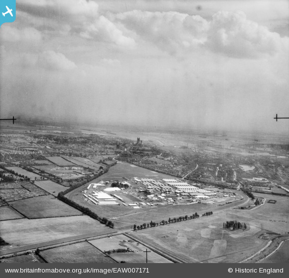
EAW007171 ENGLAND (1947). The Royal Agricultural Show Ground at West Common and the city, Lincoln, from the north-west, 1947
© Copyright OpenStreetMap contributors and licensed by the OpenStreetMap Foundation. 2026. Cartography is licensed as CC BY-SA.
Nearby Images (9)
EAW007171

EAW007180

EAW007179

EAW007175

EAW007184

EAW007177

EAW007183

EAW007185

EAW007174

Details
| Title | [EAW007171] The Royal Agricultural Show Ground at West Common and the city, Lincoln, from the north-west, 1947 |
| Reference | EAW007171 |
| Date | 25-June-1947 |
| Link | |
| Place name | LINCOLN |
| Parish | |
| District | |
| Country | ENGLAND |
| Easting / Northing | 495962, 372313 |
| Longitude / Latitude | -0.56195700074753, 53.238881442198 |
| National Grid Reference | SK960723 |
