
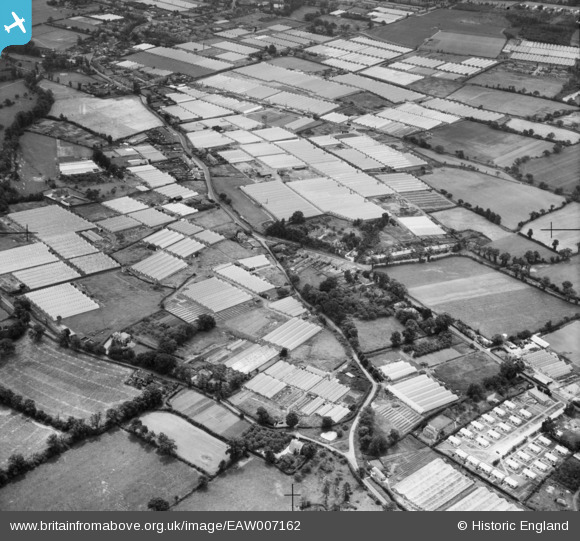
EAW007162 ENGLAND (1947). Glasshouses off Holbeck Lane and Longfield Lane, Flamstead End, 1947
© Copyright OpenStreetMap contributors and licensed by the OpenStreetMap Foundation. 2025. Cartography is licensed as CC BY-SA.
Nearby Images (4)
EAW007162

EAW007157

EAW007160

EAW007161

Details
| Title | [EAW007162] Glasshouses off Holbeck Lane and Longfield Lane, Flamstead End, 1947 |
| Reference | EAW007162 |
| Date | 21-July-1947 |
| Link | |
| Place name | FLAMSTEAD END |
| Parish | |
| District | |
| Country | ENGLAND |
| Easting / Northing | 533891, 203952 |
| Longitude / Latitude | -0.06156346400406, 51.717833174579 |
| National Grid Reference | TL339040 |
Pins
Be the first to add a comment to this image!