
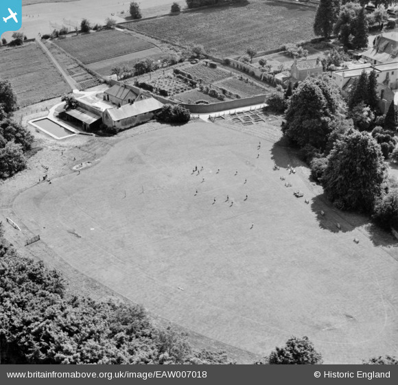
EAW007018 ENGLAND (1947). The Oakley Hall School playing field, Cirencester, 1947
© Copyright OpenStreetMap contributors and licensed by the OpenStreetMap Foundation. 2026. Cartography is licensed as CC BY-SA.
Nearby Images (12)
EAW007018

EAW007020

EAW007022

EAW007017

EAW007016

EAW007024

EAW007019

EAW007021

EAW007026

EAW007025

EAW007015

EAW007023

Details
| Title | [EAW007018] The Oakley Hall School playing field, Cirencester, 1947 |
| Reference | EAW007018 |
| Date | 11-June-1947 |
| Link | |
| Place name | CIRENCESTER |
| Parish | CIRENCESTER |
| District | |
| Country | ENGLAND |
| Easting / Northing | 402454, 200934 |
| Longitude / Latitude | -1.9644819792154, 51.706679148932 |
| National Grid Reference | SP025009 |
Pins
Be the first to add a comment to this image!