
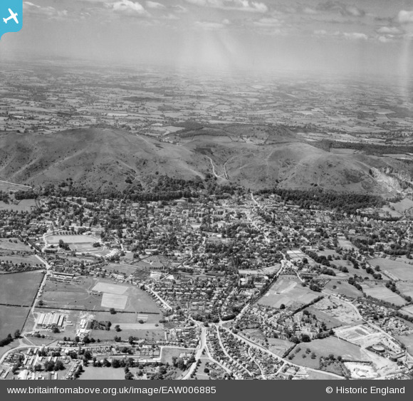
EAW006885 ENGLAND (1947). The Malvern Hills and the town, Great Malvern, from the east, 1947
© Copyright OpenStreetMap contributors and licensed by the OpenStreetMap Foundation. 2026. Cartography is licensed as CC BY-SA.
Nearby Images (7)
EAW006885

EPW033922

EPW006020

EPW041827

EPW000184

EPW000193

EPW000188

Details
| Title | [EAW006885] The Malvern Hills and the town, Great Malvern, from the east, 1947 |
| Reference | EAW006885 |
| Date | 10-June-1947 |
| Link | |
| Place name | GREAT MALVERN |
| Parish | MALVERN |
| District | |
| Country | ENGLAND |
| Easting / Northing | 378358, 245738 |
| Longitude / Latitude | -2.3160485919695, 52.109133202075 |
| National Grid Reference | SO784457 |
Pins

BobE |
Monday 3rd of March 2014 10:56:21 AM | |
|
BobE |
Monday 3rd of March 2014 10:55:26 AM | |

Chris Samuel |
Wednesday 6th of November 2013 08:17:40 AM |