
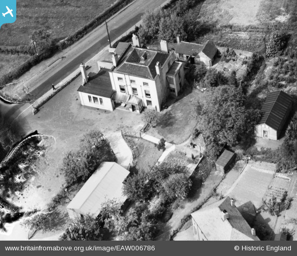
EAW006786 ENGLAND (1947). The Beacon, Madeley, 1947. This image has been produced from a damaged negative.
© Copyright OpenStreetMap contributors and licensed by the OpenStreetMap Foundation. 2026. Cartography is licensed as CC BY-SA.
Nearby Images (4)
EAW006786

EAW006784

EAW006783

EAW006785

Details
| Title | [EAW006786] The Beacon, Madeley, 1947. This image has been produced from a damaged negative. |
| Reference | EAW006786 |
| Date | 28-May-1947 |
| Link | |
| Place name | MADELEY |
| Parish | MADELEY |
| District | |
| Country | ENGLAND |
| Easting / Northing | 368168, 303989 |
| Longitude / Latitude | -2.4703844655433, 52.63236790985 |
| National Grid Reference | SJ682040 |
Pins
Be the first to add a comment to this image!