
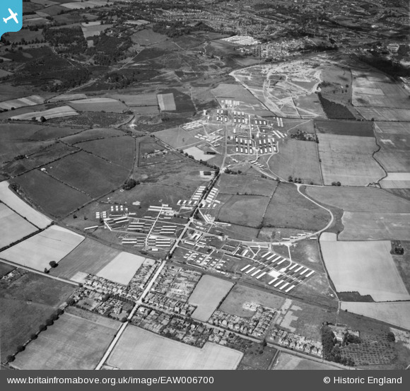
EAW006700 ENGLAND (1947). Camp Bewdley (Burlish Camp), Stourport-on-Severn, 1947
© Copyright OpenStreetMap contributors and licensed by the OpenStreetMap Foundation. 2025. Cartography is licensed as CC BY-SA.
Nearby Images (4)
EAW006700
, Stourport-on-Severn, 1947")
EAW006701
 and the outskirts of Kidderminster, Stourport-on-Severn, 1947")
EAW006697
, Stourport-on-Severn, 1947")
EAW006699
, Stourport-on-Severn, 1947")
Details
| Title | [EAW006700] Camp Bewdley (Burlish Camp), Stourport-on-Severn, 1947 |
| Reference | EAW006700 |
| Date | 28-May-1947 |
| Link | |
| Place name | STOURPORT-ON-SEVERN |
| Parish | STOURPORT-ON-SEVERN |
| District | |
| Country | ENGLAND |
| Easting / Northing | 380532, 273365 |
| Longitude / Latitude | -2.2858924567889, 52.357615903119 |
| National Grid Reference | SO805734 |
Pins
User Comment Contributions
I don't know if this is any interest to you. There's some good stuff on this site. Other photos of Bewdley from the air in 1930. |

Strudwick |
Friday 8th of November 2013 08:01:55 AM |