
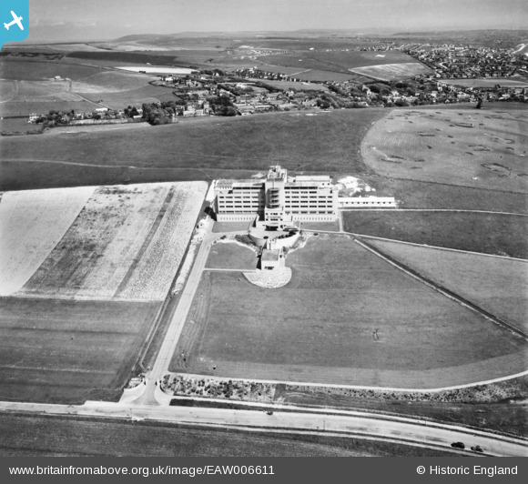
EAW006611 ENGLAND (1947). St Dunstan's Institute for Visually Impaired Army Service Personnel, Ovingdean, from the west, 1947
© Copyright OpenStreetMap contributors and licensed by the OpenStreetMap Foundation. 2026. Cartography is licensed as CC BY-SA.
Nearby Images (2)
EAW006611

EAW006612

Details
| Title | [EAW006611] St Dunstan's Institute for Visually Impaired Army Service Personnel, Ovingdean, from the west, 1947 |
| Reference | EAW006611 |
| Date | 27-May-1947 |
| Link | |
| Place name | OVINGDEAN |
| Parish | |
| District | |
| Country | ENGLAND |
| Easting / Northing | 536101, 102708 |
| Longitude / Latitude | -0.068128629915397, 50.807355073631 |
| National Grid Reference | TQ361027 |
Pins
Be the first to add a comment to this image!