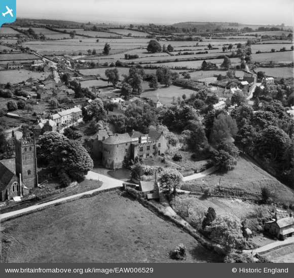
EAW006529 ENGLAND (1947). St Briavels Castle and the surrounding countryside, St Briavels, from the north-west, 1947
© Copyright OpenStreetMap contributors and licensed by the OpenStreetMap Foundation. 2026. Cartography is licensed as CC BY-SA.
Nearby Images (4)
EAW006529

EAW006530

EAW006531

EAW006532

Details
| Title | [EAW006529] St Briavels Castle and the surrounding countryside, St Briavels, from the north-west, 1947 |
| Reference | EAW006529 |
| Date | 31-May-1947 |
| Link | |
| Place name | ST BRIAVELS |
| Parish | ST. BRIAVELS |
| District | |
| Country | ENGLAND |
| Easting / Northing | 355803, 204611 |
| Longitude / Latitude | -2.6401315184171, 51.73800547945 |
| National Grid Reference | SO558046 |
Pins
Be the first to add a comment to this image!