
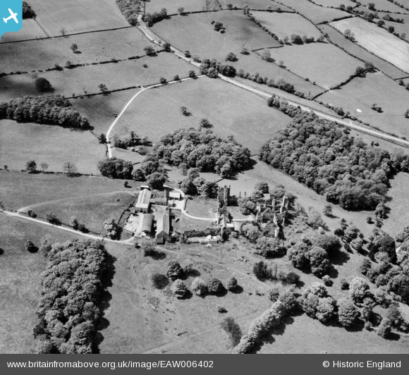
EAW006402 ENGLAND (1947). The ruins of Wingfield Manor House and Manor Farm, South Wingfield, 1947
© Copyright OpenStreetMap contributors and licensed by the OpenStreetMap Foundation. 2026. Cartography is licensed as CC BY-SA.
Nearby Images (6)
EAW006402

EAW006407

EAW006406

EAW006404

EAW006405

EAW006403

Details
| Title | [EAW006402] The ruins of Wingfield Manor House and Manor Farm, South Wingfield, 1947 |
| Reference | EAW006402 |
| Date | 27-May-1947 |
| Link | |
| Place name | SOUTH WINGFIELD |
| Parish | SOUTH WINGFIELD |
| District | |
| Country | ENGLAND |
| Easting / Northing | 437303, 354759 |
| Longitude / Latitude | -1.4429595459238, 53.088442138282 |
| National Grid Reference | SK373548 |
Pins
Be the first to add a comment to this image!