
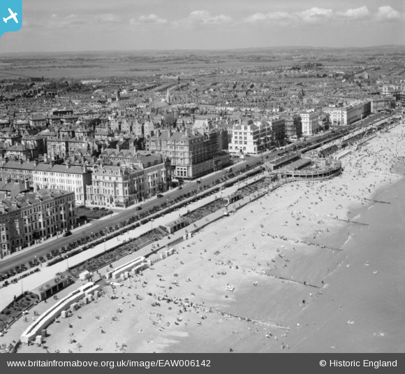
EAW006142 ENGLAND (1947). Seafront hotels along Grand Parade, the bandstand and the beach, Eastbourne, from the south-east, 1947
© Copyright OpenStreetMap contributors and licensed by the OpenStreetMap Foundation. 2026. Cartography is licensed as CC BY-SA.
Nearby Images (17)
EAW006142

EAW022971

EAW006145

EAW022969

EAW006140

EPW000747

EAW006141

EAW006143

EAW006144

EPW035323

EPW000100

EPW051369
, Eastbourne, 1936")
EPW039413
, the Grand Parade and the seafront, Eastbourne, from the south, 1932")
EAW006139

EAW026327
, Eastbourne, 1949")
EPW016883

EPW000745

Details
| Title | [EAW006142] Seafront hotels along Grand Parade, the bandstand and the beach, Eastbourne, from the south-east, 1947 |
| Reference | EAW006142 |
| Date | 27-May-1947 |
| Link | |
| Place name | EASTBOURNE |
| Parish | |
| District | |
| Country | ENGLAND |
| Easting / Northing | 561486, 98411 |
| Longitude / Latitude | 0.29002463363691, 50.7622202764 |
| National Grid Reference | TV615984 |
Pins

Mikeo1938 |
Monday 6th of October 2014 02:49:13 PM | |

Alan McFaden |
Thursday 16th of January 2014 04:06:54 PM |
