
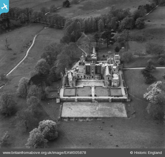
EAW005878 ENGLAND (1947). Powderham Castle, Powderham, 1947. This image has been produced from a print.
© Copyright OpenStreetMap contributors and licensed by the OpenStreetMap Foundation. 2025. Cartography is licensed as CC BY-SA.
Nearby Images (11)
EAW005878

EAW015013

EAW015014

EPW033402

EAW005879

EAW005880

EAW005876

EAW005877

EPW033401

EAW015012

EAW015011

Details
| Title | [EAW005878] Powderham Castle, Powderham, 1947. This image has been produced from a print. |
| Reference | EAW005878 |
| Date | 15-May-1947 |
| Link | |
| Place name | POWDERHAM |
| Parish | POWDERHAM |
| District | |
| Country | ENGLAND |
| Easting / Northing | 296833, 83592 |
| Longitude / Latitude | -3.4592324101746, 50.642290991896 |
| National Grid Reference | SX968836 |
Pins
Be the first to add a comment to this image!