
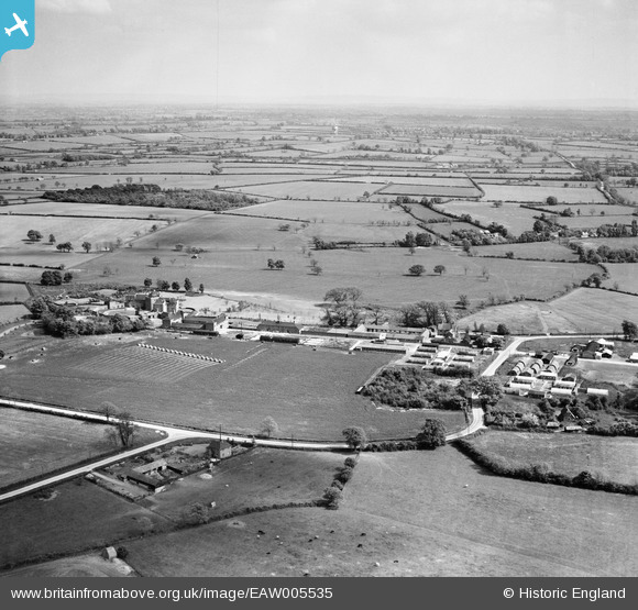
EAW005535 ENGLAND (1947). Little Horwood Manor, Manor Farm and surrounding countryside, Little Horwood, from the north-west, 1947
© Copyright OpenStreetMap contributors and licensed by the OpenStreetMap Foundation. 2026. Cartography is licensed as CC BY-SA.
Nearby Images (15)
EAW005535

EAW005541

EAW005537

EAW005540

EAW005536

EAW005539

EAW008236

EAW005538

EAW005542

EAW008229

EAW011451

EAW011447

EAW008231

EAW008232

EAW008227

Details
| Title | [EAW005535] Little Horwood Manor, Manor Farm and surrounding countryside, Little Horwood, from the north-west, 1947 |
| Reference | EAW005535 |
| Date | 17-May-1947 |
| Link | |
| Place name | LITTLE HORWOOD |
| Parish | LITTLE HORWOOD |
| District | |
| Country | ENGLAND |
| Easting / Northing | 478992, 231692 |
| Longitude / Latitude | -0.84980466702888, 51.9776431811 |
| National Grid Reference | SP790317 |
Pins

Sparky |
Thursday 28th of September 2017 05:02:05 PM | |
|
Sparky |
Thursday 28th of September 2017 05:00:01 PM | |

totoro |
Sunday 30th of November 2014 03:25:48 PM | |
|
totoro |
Sunday 30th of November 2014 03:21:51 PM | |
|
totoro |
Sunday 30th of November 2014 03:13:39 PM | |
|
totoro |
Sunday 30th of November 2014 03:11:44 PM | |
|
totoro |
Sunday 30th of November 2014 03:04:37 PM | |
|
totoro |
Sunday 30th of November 2014 02:43:16 PM |