
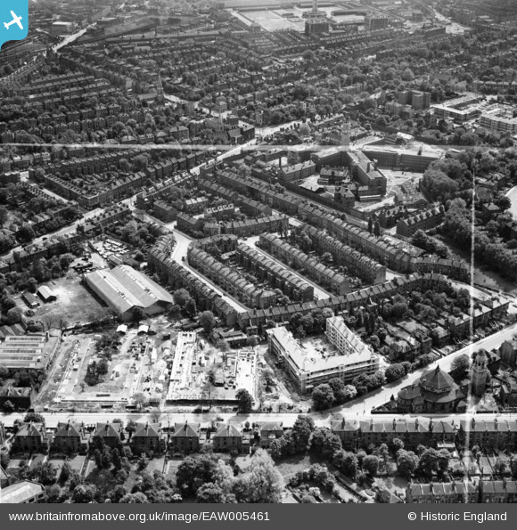
EAW005461 ENGLAND (1947). Construction of Hollins House and McCall House, Tufnell Park, 1947. This image was marked by Aerofilms Ltd for photo editing.
© Copyright OpenStreetMap contributors and licensed by the OpenStreetMap Foundation. 2026. Cartography is licensed as CC BY-SA.
Nearby Images (13)
EAW005461

EAW005458

EAW005459

EAW005455

EAW005467

EAW005456

EAW005460

EAW005462

EAW015855

EPW053670

EAW005463

EAW005466

EAW005453

Details
| Title | [EAW005461] Construction of Hollins House and McCall House, Tufnell Park, 1947. This image was marked by Aerofilms Ltd for photo editing. |
| Reference | EAW005461 |
| Date | May-1947 |
| Link | |
| Place name | TUFNELL PARK |
| Parish | |
| District | |
| Country | ENGLAND |
| Easting / Northing | 530141, 185819 |
| Longitude / Latitude | -0.12256643650794, 51.555746629512 |
| National Grid Reference | TQ301858 |
Pins

jar |
Tuesday 24th of January 2017 08:28:36 AM | |
|
billyfern |
Sunday 5th of October 2014 05:53:10 PM | |
|
billyfern |
Sunday 5th of October 2014 05:52:53 PM | |
|
billyfern |
Sunday 5th of October 2014 05:52:31 PM | |
|
billyfern |
Sunday 5th of October 2014 05:52:02 PM |