
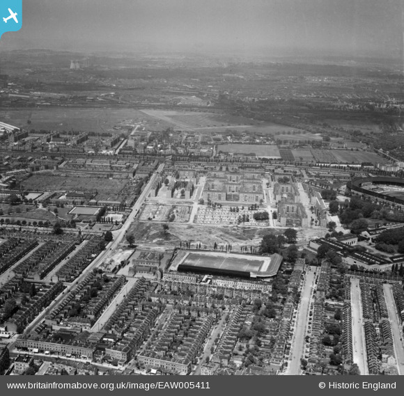
EAW005411 ENGLAND (1947). The White City Estate and Loftus Road Football Ground, Shepherd's Bush, from the south, 1947
© Copyright OpenStreetMap contributors and licensed by the OpenStreetMap Foundation. 2026. Cartography is licensed as CC BY-SA.
Nearby Images (7)
EAW005411

EPW022720

EPW022719

EPW062152

EAW005413

EAW005410

EPW022570

Details
| Title | [EAW005411] The White City Estate and Loftus Road Football Ground, Shepherd's Bush, from the south, 1947 |
| Reference | EAW005411 |
| Date | 17-May-1947 |
| Link | |
| Place name | SHEPHERD'S BUSH |
| Parish | |
| District | |
| Country | ENGLAND |
| Easting / Northing | 522738, 180439 |
| Longitude / Latitude | -0.23118239823774, 51.509049955796 |
| National Grid Reference | TQ227804 |
Pins

redmist |
Tuesday 26th of December 2023 01:34:17 PM | |
|
redmist |
Tuesday 26th of December 2023 01:30:22 PM |