
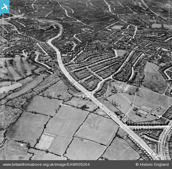
EAW005264 ENGLAND (1947). The Great North Way, Hendon, from the north-west, 1947
© Copyright OpenStreetMap contributors and licensed by the OpenStreetMap Foundation. 2026. Cartography is licensed as CC BY-SA.
Nearby Images (4)
EAW005264

EPW010849

EAW005265

EAW005263

Details
| Title | [EAW005264] The Great North Way, Hendon, from the north-west, 1947 |
| Reference | EAW005264 |
| Date | 29-April-1947 |
| Link | |
| Place name | HENDON |
| Parish | |
| District | |
| Country | ENGLAND |
| Easting / Northing | 522933, 190540 |
| Longitude / Latitude | -0.22484204866098, 51.599796478411 |
| National Grid Reference | TQ229905 |
Pins

Matt Aldred edob.mattaldred.com |
Thursday 7th of March 2024 02:51:31 PM | |
|
Matt Aldred edob.mattaldred.com |
Monday 10th of April 2023 05:33:35 PM | |
|
Matt Aldred edob.mattaldred.com |
Monday 10th of April 2023 05:32:26 PM | |

Class31 |
Saturday 22nd of March 2014 05:52:18 PM |