
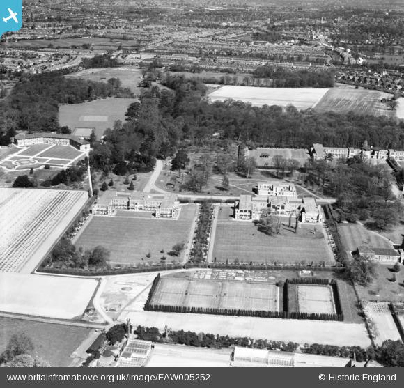
EAW005252 ENGLAND (1947). Bethlem Royal Hospital and environs, Upper Elmers End, 1947
© Copyright OpenStreetMap contributors and licensed by the OpenStreetMap Foundation. 2026. Cartography is licensed as CC BY-SA.
Nearby Images (15)
EAW005252

EAW005254

EAW005251

EAW005258

EAW005259

EPW034532

EAW005247

EPW034533

EAW005248

EPW034534

EAW005250

EAW005253

EAW005249

EAW005255

EAW005257

Details
| Title | [EAW005252] Bethlem Royal Hospital and environs, Upper Elmers End, 1947 |
| Reference | EAW005252 |
| Date | 29-April-1947 |
| Link | |
| Place name | UPPER ELMERS END |
| Parish | |
| District | |
| Country | ENGLAND |
| Easting / Northing | 537088, 166648 |
| Longitude / Latitude | -0.0298477099285, 51.381807061317 |
| National Grid Reference | TQ371666 |
Pins
Be the first to add a comment to this image!