
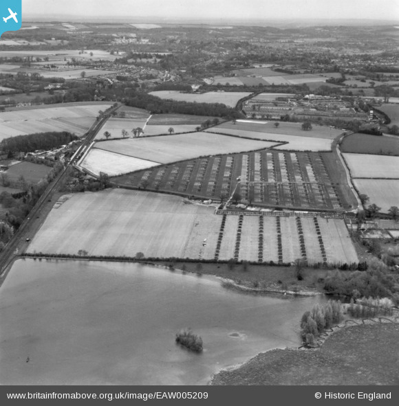
EAW005209 ENGLAND (1947). A poultry farm, Milford, from the south, 1947. This image has been produced from a print.
© Copyright OpenStreetMap contributors and licensed by the OpenStreetMap Foundation. 2026. Cartography is licensed as CC BY-SA.
Nearby Images (12)
EAW005209

EPW024856

EAW005208

EPW024851

EPW024855

EPW024850

EPW024852

EPW024853

EPW024857

EPW024854

EPW024858

EPW024859

Details
| Title | [EAW005209] A poultry farm, Milford, from the south, 1947. This image has been produced from a print. |
| Reference | EAW005209 |
| Date | 29-April-1947 |
| Link | |
| Place name | MILFORD |
| Parish | WITLEY |
| District | |
| Country | ENGLAND |
| Easting / Northing | 495408, 140797 |
| Longitude / Latitude | -0.63552753226276, 51.157938130777 |
| National Grid Reference | SU954408 |
Pins

John Wass |
Wednesday 30th of December 2015 08:15:02 PM |