
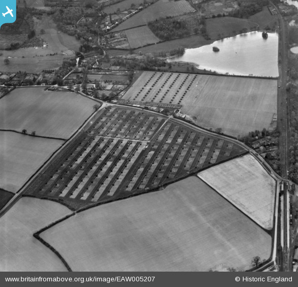
EAW005207 ENGLAND (1947). A poultry farm, Milford, 1947. This image has been produced from a print.
© Copyright OpenStreetMap contributors and licensed by the OpenStreetMap Foundation. 2026. Cartography is licensed as CC BY-SA.
Nearby Images (6)
EAW005207

EPW024854

EPW024859

EPW024852

EPW024850

EPW024853

Details
| Title | [EAW005207] A poultry farm, Milford, 1947. This image has been produced from a print. |
| Reference | EAW005207 |
| Date | 29-April-1947 |
| Link | |
| Place name | MILFORD |
| Parish | WITLEY |
| District | |
| Country | ENGLAND |
| Easting / Northing | 495659, 141125 |
| Longitude / Latitude | -0.63185172900972, 51.160845083288 |
| National Grid Reference | SU957411 |
Pins
Be the first to add a comment to this image!