
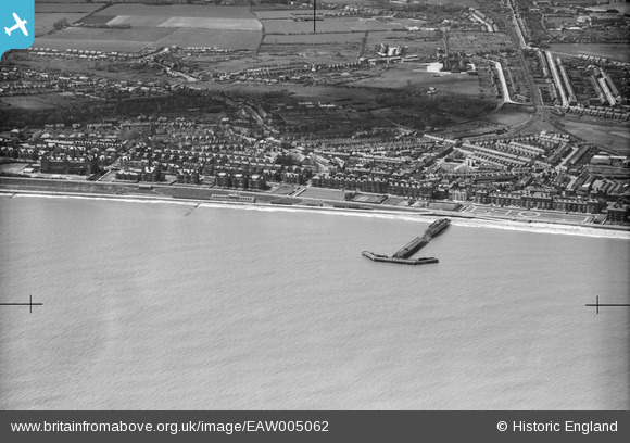
EAW005062 ENGLAND (1947). Claremont Pier and the seafront, Lowestoft, 1947
© Copyright OpenStreetMap contributors and licensed by the OpenStreetMap Foundation. 2024. Cartography is licensed as CC BY-SA.
Nearby Images (7)
EAW005062

EPW021240

EPW001897

EAW025477

EPW021246

EPW021247

EAW025478

Details
| Title | [EAW005062] Claremont Pier and the seafront, Lowestoft, 1947 |
| Reference | EAW005062 |
| Date | 11-May-1947 |
| Link | |
| Place name | LOWESTOFT |
| Parish | |
| District | |
| Country | ENGLAND |
| Easting / Northing | 654440, 291769 |
| Longitude / Latitude | 1.746206683602, 52.464091585963 |
| National Grid Reference | TM544918 |
Pins
 Bart |
Thursday 29th of October 2020 10:01:12 PM | |
Bart |
Thursday 29th of October 2020 09:58:55 PM | |
Peter |
Tuesday 3rd of December 2013 09:23:13 PM | |
Peter |
Tuesday 3rd of December 2013 09:22:00 PM | |
Peter |
Tuesday 3rd of December 2013 09:20:39 PM |


