
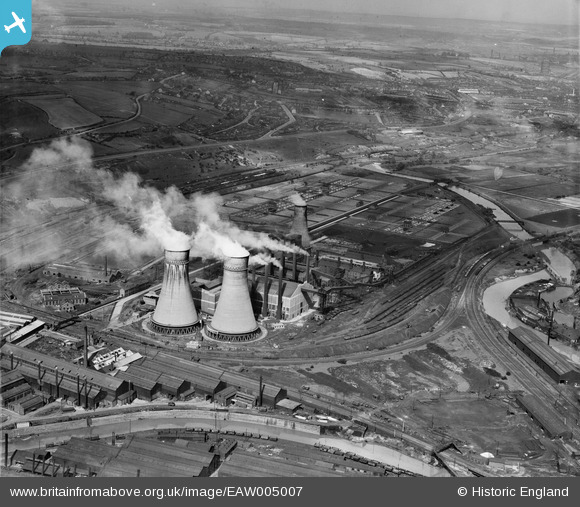
EAW005007 ENGLAND (1947). The Blackburn Meadows Power Station, Tinsley, from the south, 1947
© Copyright OpenStreetMap contributors and licensed by the OpenStreetMap Foundation. 2026. Cartography is licensed as CC BY-SA.
Nearby Images (9)
EAW005007

EAW005011

EAW005014

EAW005013

EPW039003

EPW039000

EPW039001

EPW039002

EPW039005

Details
| Title | [EAW005007] The Blackburn Meadows Power Station, Tinsley, from the south, 1947 |
| Reference | EAW005007 |
| Date | 7-May-1947 |
| Link | |
| Place name | TINSLEY |
| Parish | |
| District | |
| Country | ENGLAND |
| Easting / Northing | 439608, 391325 |
| Longitude / Latitude | -1.40399006887, 53.416980729264 |
| National Grid Reference | SK396913 |
